Questions for you GPS guys ????????

Hey guys, I am thinking of getting a good GPS unit.
I have heard Garmin is good.
What brand do you like the best ?
I am wanting it to do the following,...
Tell the best hunting fishing times, mark 500 + way points, tell speed and altitude,...and if
I am not mistaken, don't some already have highway and city maps in them ??
Any advice will be appreciated as I am overwhelmed with all the choices and brands on the market.
thanks
ckm
 
i have had 3 different g.p.s.units,i have a magellan merdian platinum i like this the best of all it has a eletronic compass,sd.card to download detailed topo maps,barometer,free downloads garmin charges for theirs.i got it on ebay with a cd.and all the cables.it shows all the springs and gullies has elevation lines great for dog hunting.
 
Check out the Garmin GPSMap76S, I think it will handle everything that you need. It has black and white display so the prices should be down now that Garmin came out with their super duper color screen model.
 
I have the Rhino 120 GPS and radio. I really like it. I can upload topo maps, it has already built into it a cities map. Plus it's an FR Radio that allows you to send your position to another Rhino user. This helps when hunting with people that are not familiar with the area. Me and a buddy went elk hunting in an area he was familiar with but I was not. We would do a drive and I could tell where he was all the time by sending our locations back and forth. It really made me comfortable hunting this new area. You can set tracks waypoints, figure out the sunrise, the moon faze, and yes it tells you the best hunting days and times. It has a couple of games on it even games using the GPS with other Rhino users. Has a compass elevation speed area calculation and much more. Would not use any other GPS! Also I would not get the Rhino 110 because it does not allow uploading maps. I like that ability for the topo maps.

rino120pic.jpg


Here is an URL on a write up: Garmin Rhino GPS and FRS Radio
 
I have had the Magellan SporTrak Topo since summer. I like it a lot and it has been very accurate. My wife has a Garmin Foretrex and when geocaching we can both end up at a coordinate point within feet of each other. I use mine mostly when hunting, and the topo features are helpful, but the elevation lines are not as detailed as I would like them to be. The road systems are incredible though. I can track grown over 2-tracks with it. I got mine from zipzoomfly.com for under $300. I'm very happy with it.
 
First and foremost, my advice to anyone looking to get a GPS, is get one with a "joystick" button on the front. Otherwise you'll be pushing a 5 buttons to do the work of that one button.

Second, you must get a topo map program for it (if you're using it for outdoors). I did without the program for a year, and I had no idea what I missing for $100.

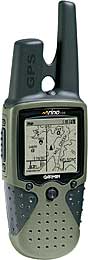
I've got a Garmin E-trex legend. Great unit. I bought it for over $200, but they can be had for about $150 now. I also got the US Topo map CD's for it a few months ago. The maps themselves are somewhat lame as far as topo features go (it's equivelant to a 1 to 100k map they say) but it will show darn near every dirt road, creak, tanks, topo features, etc.

My unit has 8mb storage space on it. With all of AZ topo maps downloaded, and over 200 waypoints, I'm using about 8% of available space I think.

The map program adds tons of versatality to the unit. I now only keep waypoints on the unit for the area I'm going to. The rest are downloaded and stored in the computer. So now I only have to sort through 20 or 30 waypoints when I'm out, instead of over 200.

Last week, I had my brother meet me out a hunting site I'd not been to in 20 years, and he'd not been to ever. Using the map program, and measuring tool, I was able to give him directions in miles (10.3 miles, turn left, etc). I was amazed that I could go 13 miles down a very bad and winding primitive road, and have the directions be accurate to 1/10th of a mile!!! Amazing.

The garmins have a "base map" already on them, which will show most large roads. They will show cities (and even tiny towns) rest stops, and exits. They'll tell you what's available at the exit (exxon, McDonalds, propane, etc.)

It has a hunt / fish times calendar on it. Area calculations. Trip computer (total time, moving time, speed, highest speed.) Sunrise and sunset times, which is a nice feature when hunting. I know if I am on my last stand at the time it tells me it is sunset, I've got enough time left for a complete stand.

When using one, I would HIGHLY recommend using "UTM" coordinates with a "NAD 27" datum (if you've done time in the military, that system will be familiar to you). Stay away from Latitude and Longitude. Those who know what they're doing will usually use UTM coordinates when using maps or GPS for ground use. Easy to convert to paces for walking, and milage for driving. Lat and Lon is a pain in the ass.

Lastly, if you want the latest and greatest info on GPS, try a "Geocache" message board. They're the "techno-geeks" of the industry I guess you could say. Geocache is a game where people hide things, and find them, using GPS. They're usually very "up" and informed on the latest GPS info.

Good Luck!
 
Garmin 60c very user friendly cabellas 440$ gps discount 340$ this is a fantistic unit you get city select version 6 works very good.
 
I will second the Etrex Legend. I really like it and it really works well for the dirt roads that we all travel chasing these crazy critters. It seems every dirt road in Eastern CO made the map. Very nice unit I would say. Bigger screen would be nice though.

Brent
 
I have a magelland 315 and it works very well. BUT I would like to get he Rhino 120 or the next step up. I like the walkie talkie option and the option of pin pointing your partners Rhino while you are miles away. a tad over 200 bucks I think,
 
Back
Top